As Austin heads into another busy season on its streets, Mueller residents are navigating a familiar tension: a fast-growing city, a neighborhood designed for walking and biking, and a persistent struggle to end deadly crashes. Citywide population now approaches 1 million, according to the United States Census Bureau, a scale that concentrates daily travel on neighborhood arterials and intersections where small design choices can have life-or-death consequences.
A growing city shapes neighborhood streets
Austin’s size and demographics help explain the pressure on neighborhood corridors. The city’s population estimate sits at 993,588, the United States Census Bureau reports. It remains relatively young, with a median age around 34.5 years, and economically strong, with median household income near $91,461, according to Texas Demographics. Racial and ethnic composition is diverse—roughly 47–48% White, 32–33% Hispanic or Latino, 8–9% Asian, and about 7–8% Black—based on analyses from CensusDots.
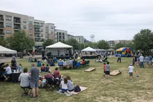
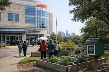
That citywide picture shows why neighborhoods like Mueller, with busy sidewalks, bike routes, and retail blocks woven into residential streets, keep a close eye on safety data and design.
What the crash data shows—and how it gets to the map
Behind the scenes of every safety plan is a pipeline of police reports and data checks. The Austin Crash Report dataset contains records for crashes within the city’s full-purpose boundaries for the last 10 years and is a primary source for the city’s Vision Zero analysis, according to the City of Austin Data Portal. City staff note that crash reports can take weeks to be submitted, reviewed and finalized, so public updates typically lag by about two weeks and, in some cases, longer depending on investigations, the City of Austin Data Portal explains.
The source of record is the statewide Crash Records Information System, or CRIS, managed by the state’s transportation department. CRIS aggregates reports from Texas peace officers, including Austin police, and provides public query tools and annual summaries spanning a decade of data plus the current year, according to the Texas Department of Transportation. For residents and planners in Mueller, that means decisions about crosswalks, signals and speed management are grounded in a consistent, statewide reporting system—one that balances timely updates with accuracy.
Citywide safety trends—and where the worst crashes happen
The top-line story is sobering. Through Oct. 22, 2025, Austin recorded 79 fatal crashes and 83 fatalities, up from 69 fatal crashes and 74 fatalities at the same point in 2024, according to VisionZeroATX. At the same time, serious injuries are at their lowest since the city embraced Vision Zero in 2015, yet overall fatalities have remained relatively flat, VisionZeroATX reports. A majority of deaths—an estimated 65% to 75%—occur on roads owned by agencies other than the city, such as the state transportation department, underscoring the jurisdictional coordination needed to protect people traveling to and from neighborhoods like Mueller, VisionZeroATX adds.
The human stakes are plain. “If today is an average day on the streets and roads of Texas, 11 people will die in a sudden, violent, unexpected event,” said Jay Crossley, executive director of Farm & City, in a statement shared by VisionZeroATX.
Design fixes that save lives—and dollars
Even as fatality counts challenge Austin’s goals, intersection redesigns are delivering measurable gains. Safety upgrades at 22 major intersections produced a 22% reduction in fatal and serious-injury crashes, while all injury-related crashes fell nearly 30%—roughly 40 fewer people injured or killed each year at those locations, according to VisionZeroATX. The economic case is striking: $18.5 million in construction costs are yielding more than $28 million annually in crash-cost savings, VisionZeroATX reports.
Those findings resonate in walkable districts like Mueller, where daily trips often begin and end on neighborhood streets but cross major corridors on the way to schools, parks, clinics and shops. Targeted changes—tighter turning radii, better signal timing, high-visibility crosswalks—are the kind of proven tools the city is using where data points to risk.
What this means for Mueller residents and planners
For people who live, work and play in Mueller, three citywide realities now shape the local conversation:
- Crash records flow through a statewide system and appear publicly after quality checks, often about two weeks after a crash, according to the City of Austin Data Portal and the Texas Department of Transportation.
- Fatal crashes have trended higher so far this year even as serious injuries reached their lowest levels since 2015, VisionZeroATX reports.
- Intersection redesigns are reducing severe crashes and saving money, with a 22% drop in fatal and serious injuries across 22 sites, per VisionZeroATX.
Taken together, those points suggest a clear path forward: use the statewide CRIS backbone to understand where risk concentrates; deploy intersection fixes that reduce conflicts; and coordinate across city and state agencies to address deadly corridors. That approach fits the daily rhythms of Mueller, where safe crossings and predictable speeds determine whether families choose to walk, bike or drive.
As Austin continues to grow—diverse, relatively young and economically dynamic—the city’s safety strategy will increasingly be judged block by block in neighborhoods like Mueller. The numbers show both urgency and promise: a need to bend the fatality trend line even as proven design can lower severe crashes and costs. If Austin can align data, design and interagency work, Mueller’s streets could model how neighborhood-scale changes add up to citywide progress.
Data extracted from catalog.data.gov