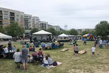
District 1 begins close to the familiar density of Central Austin and then runs north toward Howard Lane, fanning out into some of the city’s broadest open spaces east of State Highway 130. On maps, it reads as a long sweep of neighborhoods and fields; on the ground, it’s where the city’s fastest change meets the city’s most durable fault lines. The district carries an official nickname that is both aspiration and warning label: the “African American Opportunity District,” so called because it contains Austin’s largest share of African American voters.
Yet the district’s significance is sharpened by a paradox that has come to define modern Austin. The city spent the early 2000s becoming a national symbol of boomtown growth—and simultaneously watched its Black population shrink.
“Among the ten fastest-growing major cities in the United States, Austin stood out in one crucial respect: it was the only such city that suffered a net loss in its African- American population.,” said Eric Tang, Researcher, UT Austin Institute for Urban Policy, Research, and Analysis. https://www.kut.org/austin/2014-05-16/austins-the-only-fast-growing-city-in-the-country-losing-african-americans?utm_source=openai
Tang’s analysis put numbers on what many longtime residents felt in their bones. From 2000 to 2010, Austin’s population grew by about 20.4%—but its African American population fell by 5.4%, according to Tang’s report as summarized by KUT. In a city that sells itself on opportunity, that reversal demands an explanation. And in District 1, the clues are not only demographic. They’re built into the street grid, the rail lines, the bus routes that exist—and the ones that don’t.
The story of District 1 is often narrated as a contest between rising property values and a community trying to hold on. But that shorthand skips a crucial middle layer: the policies that decided where people could live, the infrastructure that determined how they could move, and the investment patterns that turned mobility into a gatekeeping tool.
A city designed to separate
Austin’s segregation wasn’t accidental drift. It was written into the city’s planning.
In the late 1920s, Austin adopted a sweeping plan that offered a blueprint for where development would go—and, just as consequentially, where it wouldn’t. Tang has pointed to the 1928 Master Plan as a turning point, describing how it institutionalized segregation by designating a “Negro district” on the East Side. Those boundaries shaped everything that followed: where civic resources were concentrated, where infrastructure was prioritized, and where communities built their institutions because they had little choice.
“It is the history of segregation of the African-American community in Austin, followed by an intense period of gentrification of the neighborhoods to which they were segregated.,” said Eric Tang, Researcher, UT Austin Institute for Urban Policy, Research, and Analysis. https://www.kut.org/austin/2014-05-16/austins-the-only-fast-growing-city-in-the-country-losing-african-americans?utm_source=openai
If the 1928 plan helped funnel Black Austinites east, subsequent decades hardened that funnel into a boundary with a physical signature: Interstate 35. For residents who grew up in Austin before the city’s reinvention, the highway is not just a transportation facility; it’s a line that ordered daily life.
“It was where our churches and stores and business were. It was the hub center for African Americans,” said Reverend Sylvester Chase Jr., Longtime Pastor. https://www.kut.org/post/austins-population-booming-why-its-african-american-population-shrinking?utm_source=openai
“I didn’t see white people. You didn’t cross 35 — I’m talking about white people.,” said Reverend Sylvester Chase Jr., Longtime Pastor. https://www.kut.org/post/austins-population-booming-why-its-african-american-population-shrinking?utm_source=openai
For years, East Austin was the designated place to live, work, worship, shop, and build community. Then, in the 1990s and 2000s, the same geography that had served as a container became a commodity. Neighborhoods that had been shaped by disinvestment and segregation suddenly became “close-in” and “up-and-coming,” and the city’s market logic flipped: the East Side was now valuable precisely because it was adjacent to downtown.
That inversion carried a double penalty. Families who had endured segregation found their neighborhoods targeted for redevelopment, and their ability to stay depended on household wealth, property tax pressures, and access to the kinds of jobs Austin was increasingly creating. In other words, it wasn’t simply that the city changed. It changed in ways that rewarded those already positioned to benefit.
Transit as an engine of inequality
In District 1, transportation isn’t just about convenience. It’s about whether opportunity is reachable.
Public transit, especially, functions like an invisible wage. A reliable east-west connection can reduce commute time, broaden job options, and make child care, school, and health appointments feasible without a car. When that connection is missing, the cost isn’t theoretical; it shows up as missed hours, narrower employment options, and daily stress.
That’s why one of District 1’s persistent challenges is the lack of reliable public transportation—particularly east-west service that connects residents to job centers. Peck Young, with Austin Community College’s Center for Public Policy and Political Studies, has argued that the district’s transit gaps are not random. They follow an older logic of who is meant to move efficiently through the city.
Young points to what he calls a “fixation” in Austin’s transportation planning: major investments that run north to south. In his telling, that pattern can be traced to policies dating back to the Jim Crow era—an outlook that treated some neighborhoods as places to pass through, not places to serve.
The system’s priorities are visible in the shape of the region’s marquee projects. The Red Line runs from Leander to downtown near the Convention Center, and the proposed rail alignments discussed for years have also tended to reinforce a north-south spine, connecting campuses and corridors along a similar axis. Those routes matter, but they can also reinforce a particular idea of the “typical” commuter: someone traveling from northern suburbs into the core.
Meanwhile, District 1’s needs frequently run across that grain.
Young’s most pointed evidence is historical, and it lands with uncomfortable clarity: the rare moment East Austin did have strong transit options was explicitly tied to a racialized labor economy.
“40, maybe 50 years ago, there was a bus line that ran from black East Austin to jobs in West Austin. At that time it was mostly service jobs, for maids, nannies and chauffers,” Young said in reporting by KUT. When that service ended—because its racist implications became harder to justify—what disappeared with it was not just a problematic artifact of the past, but a practical lifeline.
“We haven’t had decent east-west mass transit since,” Young said in the same KUT report. The result was a familiar metropolitan pattern: households who could afford to drive did, and those who couldn’t were left with longer, less reliable commutes—often to jobs increasingly scattered across a growing region.
The severed link Young describes is one of the most consequential forms of inequity because it compounds others. If a resident can’t reach a job center without owning a car, the barriers aren’t only financial. They become structural: fewer job choices, less ability to take training classes, less flexibility in scheduling, and fewer opportunities to build wealth.
The broader pressure points
Tang’s research makes clear that transportation is only one strand in a larger rope of constraints.
“In all three areas what we believe is that African-Americans face persistent inequalities.,” said Eric Tang, Researcher, UT Austin Institute for Urban Policy, Research, and Analysis. https://www.texasstandard.org/stories/austins-the-only-fast-growing-city-in-the-country-losing-african-americans/?utm_source=openai
Tang points specifically to public education, policing, and access to the job market as interconnected domains where disparities persist. In schools, he has described a sense among families that the gains of earlier decades have eroded.
“In the Austin Independent School District, many parents I have talked to anecdotally in our research have … argued that their grandchildren and children are receiving an inferior education to what they got in the post-Civil Rights years.,” said Eric Tang, Researcher, UT Austin Institute for Urban Policy, Research, and Analysis. https://www.texasstandard.org/stories/austins-the-only-fast-growing-city-in-the-country-losing-african-americans/?utm_source=openai
Each of these inequities touches transit. Schools that feel out of reach without a car shape enrollment choices. Policing patterns influence how safe people feel traveling and waiting at stops. And a job market tilted toward high-growth sectors can become even more exclusive when training sites, interviews, and employment centers are geographically remote.
Together, they help explain why the shrinking of Austin’s African American population isn’t just about individual preference or “moving on.” It is about a city whose growth model has too often treated displacement as an externality.
The investment frontier: District 1’s undeveloped land
The part of District 1 that is easiest to overlook—because it is literally empty on many maps—is also the part that may determine its future.
A City of Austin study from 2010 found that about one-third of Austin’s land remained undeveloped, and District 1 contained most of it, according to reporting by KUT. In a city where housing costs have been a defining political issue, that statistic is more than trivia. It is leverage.
Undeveloped land can mean different things depending on who gets to shape it. For planners and developers, it represents capacity: room for housing, jobs, and new infrastructure without the high costs of redeveloping dense neighborhoods. For residents who have watched redevelopment sweep through historic Black enclaves, it can also represent a new round of uncertainty—a blank slate that might be filled without them.
It is tempting, in civic conversations, to treat “development” as an automatic good, a metric that can be counted in cranes, permits, and ribbon cuttings. District 1 complicates that narrative. If investment arrives as purely market-rate housing and car-oriented commercial corridors, it can deepen the very patterns that have fueled displacement: rising land values, escalating taxes, and a built environment that assumes every household drives.
But if development arrives with the infrastructure and policy guardrails that many District 1 residents have long sought—jobs that match local skill sets and wages, transit that connects east-west as well as north-south, and housing options that allow existing residents to stay—it could change the trajectory. The district’s open land makes that dual possibility unusually stark.
In Austin, growth has often been sold as a rising tide. District 1 has lived the fine print: tides can also wash people out.
Belonging, visibility, and the cost of being unseen
The demographic shift Tang documented—rapid citywide growth paired with a shrinking Black population—also registers culturally, in ways that numbers alone can’t capture.
“If I get past 10, I’m like, ‘Wow, there are a lot of black people out today,’” said Natalie Madeira Cofield, Writer. https://www.texastribune.org/2014/07/18/african-american-austin/?utm_source=openai
Cofield’s observation, published by The Texas Tribune, isn’t about an exact headcount. It’s about what it feels like when a city’s Black presence becomes sporadic—when gatherings that would be ordinary elsewhere become notable here. That sense of visibility ties back into politics and planning: communities that feel unseen are less likely to believe that a new rail line, a new development, or a new corridor plan is meant for them.
District 1 sits at the intersection of these forces. It is asked to carry the symbolic weight of being an “opportunity district,” even as its residents confront the practical barriers of mobility, uneven public investment, and the lingering geography of segregation.
A future measured in routes and rules
For Austin’s leaders, District 1 presents an unusually clear test of whether the city can grow without repeating its oldest patterns.
The district’s transportation story makes the stakes legible. A city can build a rail line and still fail the people who need transit most if the route choices reinforce historic corridors of wealth and commuting patterns. A city can celebrate new investment and still deepen inequality if the jobs created are out of reach—physically, educationally, or economically.
And a city can point to undeveloped land as “potential” while ignoring what potential means for the people already there: whether they will be able to afford the future they’re being promised, whether the infrastructure will serve their needs, and whether “opportunity” will mean stability as well as growth.
In District 1, the past isn’t buried. It is embedded—under the highway, in the missing east-west connections, and in the market pressures that followed the lines segregation drew. The next chapter will be written less by slogans than by decisions that are technical on paper and intimate in practice: where transit runs, what kinds of housing gets built, which jobs arrive, and whether the rules of growth finally account for the people who have paid its costs for decades.